
An Article by Kevin Bunch, a writer/communications specialist with the Canada/U.S. International Joint Commission (IJC), for the IJC’s September 2021 newsletter, Great Lakes Connection
Posted September 23rd, 2021 on Niagara At Large
A Brief Foreword by Niagara At Large reporter and publisher Doug Draper –

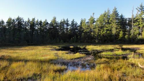
One of the provincially significant wetlands in Thundering Waters Forest in Niagara Falls, Ontario – an area now targeted for urban development. photo by Lori Monroe
In a region of Ontario where most of the great wetlands that were here when the first European settlers arrive are gone now, I hope that as many Niagara residents as possible will read the IJC article below.
Then you might also want to go online and find the contact information for the Windsor, Ontario Office of the International Joint Commission and do some satellite mapping and analysis of the wetlands we still have left before they too are possibly destroyed by predators in the development industry.
One of the most threatened areas now is a host of provincially significant wetlands in the sprawling Thundering Waters Forest in Niagara Falls, Ontario where a China-based corporation is hoping to locate a mix of residential and commercial buildings, with the ongoing blessing of a majority on the Niagara Falls city council, including the mayor.
This cluster of wetlands in Thundering Waters is located in a watershed that feeds the Niagara River, one of the major connecting channels in the Great Lakes – in a location upstream from Lake Ontario where millions of Canadians and Americans count on the health of that lake for the present and future sustenance of their communities.
Why are wetlands like the ones in Thundering Waters Forest so important?
To quote a few lines from the following IJC article – “Wetlands play important ecological and economic roles in the Great Lakes ecosystem. Wetlands provide habitat for plants and animals including migratory birds such as ducks and geese. Economically, wetlands contribute to sustaining a productive fishery by providing reproductive habitat for many species of fish. In addition to providing habitat for aquatic life, wetlands prevent damage from flooding and shoreline erosion and help reduce the flow of pollution into the waters of the Great Lakes.”
It seems that we still have too many government leaders in Niagara who either do not understand that, or don’t want to.
Now here is the IJC article –
Peat-based wetland in the northern Great Lakes basin. Credit: Great Lakes Coastal Wetland Monitoring Project
A binational group of agencies, organizations and universities has been developing a method of tracking the health of Great Lakes wetlands from space.
This effort is designed to help aid wetland managers as they work to protect and restore these vital pieces of habitat for aquatic life. Additionally, monitoring from space is far less costly than field monitoring, experts say.
Wetlands play important ecological and economic roles in the Great Lakes ecosystem. Wetlands provide habitat for plants and animals including migratory birds such as ducks and geese.
Economically, wetlands contribute to sustaining a productive fishery by providing reproductive habitat for many species of fish. In addition to providing habitat for aquatic life, wetlands prevent damage from flooding and shoreline erosion and help reduce the flow of pollution into the waters of the Great Lakes.
The satellite monitoring project, run by the Great Lakes Alliance for Remote Sensing (GLARS), uses optical photos and radar maps captured with orbiting satellites, and couples those with in-person sampling and computer algorithms.
The satellite images and sampling are done over several years, and this combination of observations is used to create robust maps of a dozen Great Lakes coastal wetlands and how they’ve changed, said Dr. Laura Bourgeau-Chavez, senior research scientist at Michigan Tech Research Institute and adjunct assistant professor at Michigan Technological University.
Bourgeau-Chavez said the GLARS project got underway in 2016 with five pilot sites: the Bay of Quinte and the Long Point National Wildlife Area in Canada, as well as Saginaw Bay, the St. Clair River delta and the Duluth-St. Louis River estuary in the United States. The scope was expanded to 12 sites in 2017 across both countries, and data collection continues across these locations.
For radar mapping, the consortium has primarily used the Canadian Space Agency’s RadarSat-2 and European Space Agency’s Sentinel-1 satellites. For optical images, they use the Worldview-2 and Worldview-3 satellites owned by Maxar Technologies. Bourgeau-Chavez said the group is interested in also using the joint US-Indian NISAR radar imaging satellite scheduled to launch in 2023.
The mapping data are fed into computer algorithms that are under development by some of the project’s partners in Canada and the United States. These algorithms, Bourgeau-Chavez said, can help break down what is seen from above and pinpoint the extent of wetlands, the depth of the water, any gains or losses of wetlands in a given area and what sort of plants are growing there.

An example of the information that can be gleaned from satellite-based optical and radar mapping: the top two images provide radar and optical images of an example wetland, and an algorithm combines this information to pick out the types of land (bottom left) and how long water covered a given area of the wetland over time (bottom right). Credit: Great Lakes Coastal Wetland Monitoring Project
For example, the monitoring effort can help identify and track the locations of invasive species like Phragmites australis, Eurasian watermilfoil or hybrid cattail for control measures, Bourgeau-Chavez said, or to see how wetland borders are shifting during high or low lake levels.
“We’ve definitely seen in our maps the effects of the shifting zones of the coastal area,” she said. “Shrubby areas get overtaken by emergent vegetation as water levels get too deep for the shrubs to handle.”
This is a natural phenomenon, though it can become a problem when an invasive species occupies much of the emergent vegetation. For Phragmites, the monitoring has been helpful particularly around Saginaw Bay on Lake Huron, where stands can extend as far as 800 meters (about half a mile) into the water.
By collecting images and radar scans at different times of the year, Bourgeau-Chavez said their monitoring algorithms can identify species from space-based platforms based on changes in vegetation throughout the year that can then be highlighted in the maps. This information is relayed to state and local management groups and agencies, who can work on removing the thick stands. A similar approach is used in the Long Point National Wildlife Area on Lake Erie in Canada.
The Saginaw Bay Cooperative Invasive Species Management Area (CISMA) recently started work on controlling 12 miles of Phragmites along the shoreline as part of a restoration initiative, and is using a map developed by the monitoring effort to help focus its efforts, Bourgeau-Chavez said.
Gedaliah Krasner, coordinator for the Saginaw Bay CISMA, said on-the-ground surveying is underway to affirm the monitoring imagery. The Phragmites removal work is scheduled for the fall.
“The satellite imagery has been completely invaluable to the work we’re doing,” Krasner said. “I don’t think it could have progressed at all without the imagery.”
The project also has shown value in identifying suitable breeding habitat for bird species like black tern, with information collected from the monitoring effort going toward a habitat suitability model being created by a University of Michigan student. In this case, the monitoring project’s contribution was providing imagery and maps of the tern breeding sites going back to 2013, mapping the changes over time to the habitat.
This can be used to see how nesting sites shift as water levels rise and fall on the lakes, which can inundate some areas with water and allow fish, such as muskie, to eat the chicks.
This year, the team behind the mapping project produced a monthly series of “Wetland Wednesday” webinars explaining their efforts and how to access the data. Data access requires directly contacting GLARS team members as of August 2021, though the goal is to have it available on a web-based server in the future, Bourgeau-Chavez said.
The team also developed an online visual story describing the work. This includes work by GLARS partners, including the University of Minnesota and SharedGeo. Other partners and members of the collaborative include Natural Resources Canada, Environment and Climate Change Canada, Michigan Technological University, Michigan Tech Institute, the Canadian Centre for Mapping and Earth Observation, and the National Wildlife Research Centre.
Bourgeau-Chavez said the work was funded by a cooperative agreement to Michigan Tech from the US Fish and Wildlife Service through the US Environmental Protection Agency (EPA), as well as an agreement with the University of Minnesota-Duluth and SharedGeo. Bourgeau-Chavez emphasized that the research has not been formally reviewed by EPA, the views expressed in this article are solely those of GLARS, and that EPA does not endorse any of the products or commercial services mentioned.
To read more from the IJC newsletter, Great Lakes Connection, click on – https://mailchi.mp/ijc.org/greatlakes-connection-09-2021?e=2df5acb1cf
To connect with the International Joint Commission’s Windsor, Ontario office, click on – https://www.ijc.org/en/who/people/great-lakes-office
NIAGARA AT LARGE Encourages You To Join The Conversation By Sharing Your Views On This Post In The Space Following The Bernie Sanders Quote Below.
